The first thing that came to my mind: establish an FKT (Fastest Known Time), a trail running speed record, on all six loops at the Bear Run Nature Reserve. My first FKT was on the Big Savage Mountain Trail in March.
On Tuesday, April 21, I threw on running shorts, laced up my trail shoes, drove the short distance to Bear Run, and ran the Red Loop followed by the White Loop, 5.47 miles at a 9:07/mile pace in 49 minutes and 50 seconds.
Neither route qualified as FKTs, as they were too short in distance - I had a feeling before submitting that this would be the case.
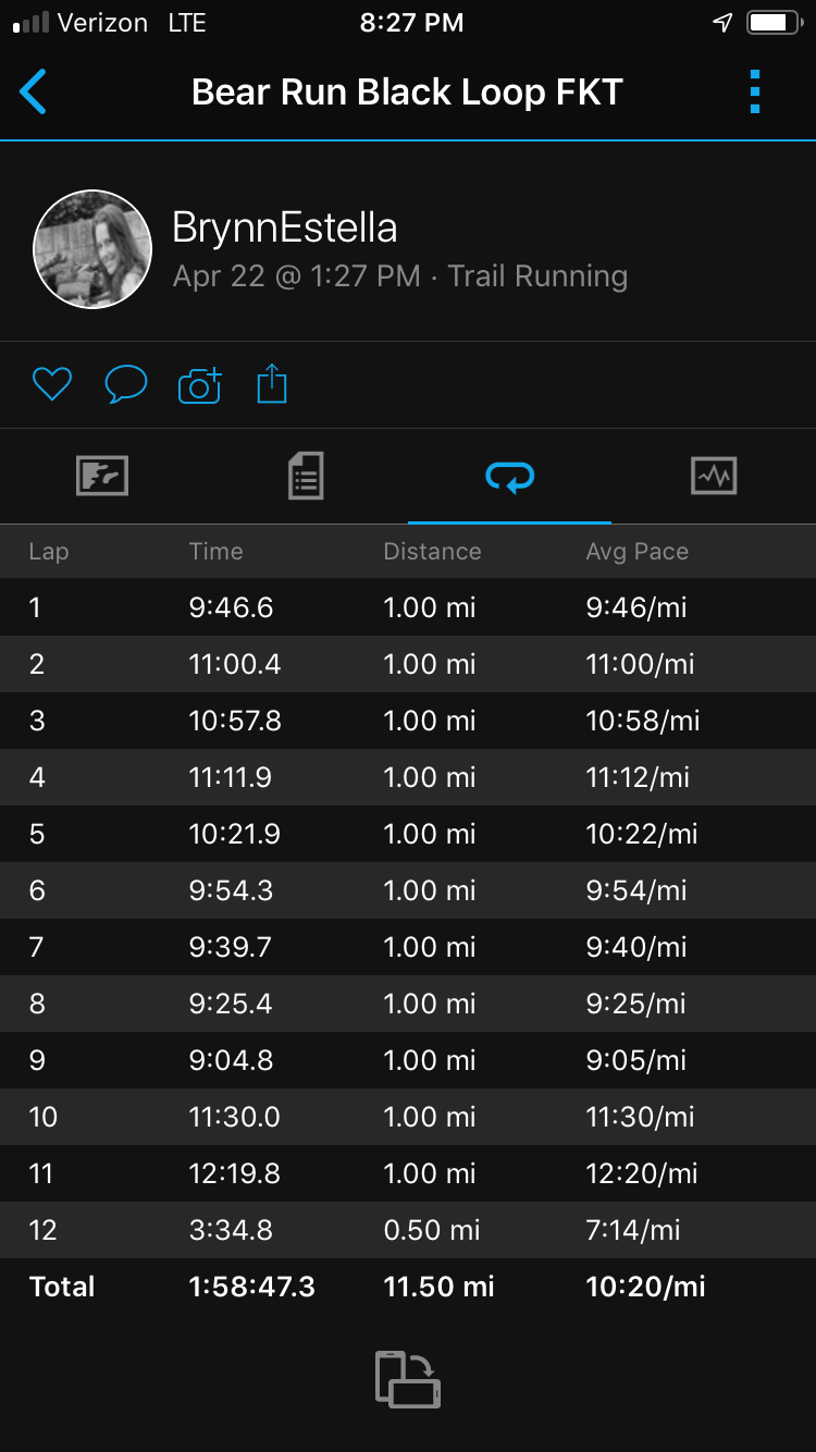
I had plans to run the wonderful and difficult 11.9-mile (according to maps, but according to my Garmin fenix, 11.5-mile) Black Loop for the finale of my FKT mission, but sought approval from the FKT authorities beforehand.
They said yes, the Black Loop represents the best route, the most and only FKT-worthy and Bear Run.
So, the next day, Earth Day, April 22, still revved and ready from the tune-up run the night before, I poured some scoops of Skratch electrolyte mix into my hydration bladder, stuffed it into my running vest, tossed on shorts, and was off.
The sun was shining, and I was quickly in the zone and zoned out, loving every foot strike, caught up in the moment, no thoughts in my head, just moving my body, keeping a natural rhythm and pace, dancing upon the rocks and through the mud.
The miles flew by, and soon it became clear that I would break two hours.
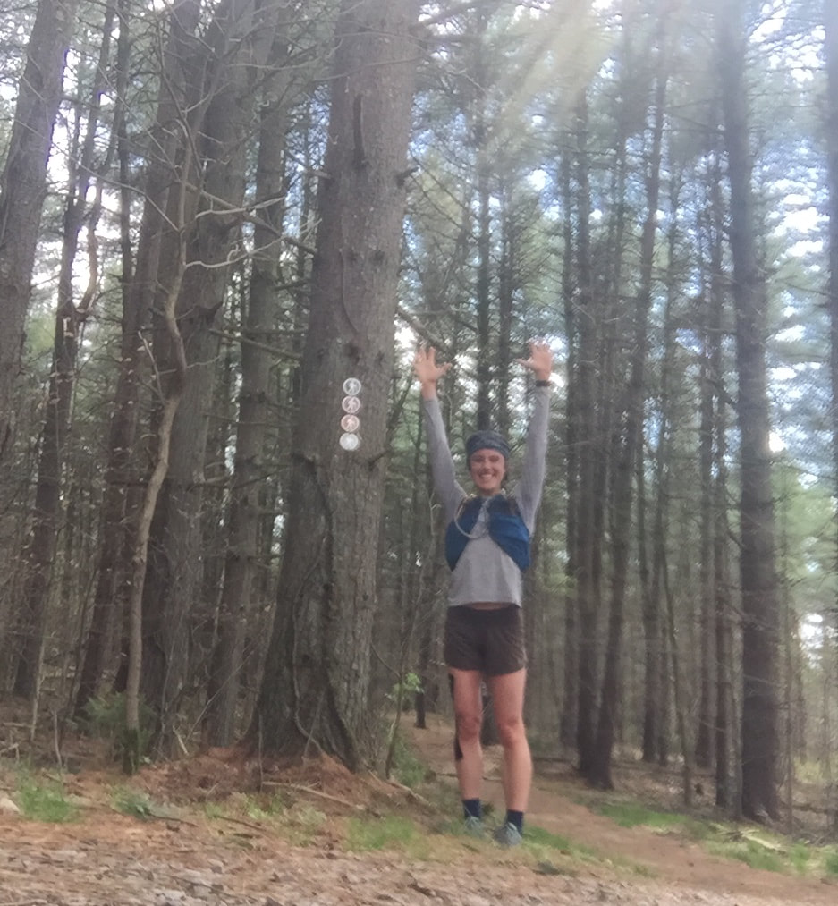
I charged up the final hill, sprinted down the gravel road straightaway, across the road and parking lot and broke the invisible tape, lungs searing, legs burning, so happy and pleased with simply giving it my all.
As the first person to establish an FKT at Bear Run, I deemed the start line and finish line to be in the exact same location, where the post that says "Trail head" sits, where dirt meets the pavement of the parking lot.
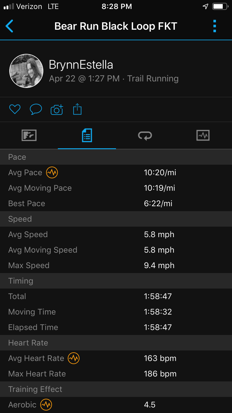
11.5 miles in 1 hour, 58 minutes, 47 seconds, and my second FKT was in the books!
Check out the details of the run, plus mile-by-mile descriptions below.
Please note that the Black Loop is one that I have come to know well over time, like the back of my hand, I have become acquainted with every turn and nuance, providing for zero time wasted on navigating or trying to locate blazes.
Bear Run Nature Reserve Black Loop
Wednesday, April 22, 2020
11.5-mile loop, running counterclockwise
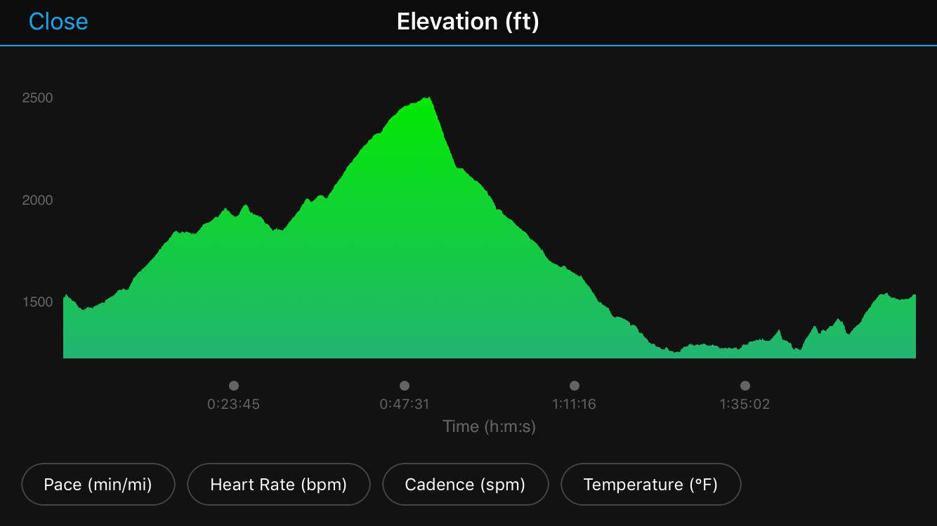
Elevation gain: 1,864 feet
Elevation loss: 1,837 feet
Weather: 46 degrees, very little no wind, sunny
Unsupported/Female
First FKT attempt at Bear Run
Trail conditions: Rather dry except in the spots that are always wet ;)
Mile one - soft pine-needle covered ground, tall trees, rhododendrons, deep green forest, an easy start, winding toward the creek
Mile two - the first climb, which is the third steepest climb of the entire route, framed by flowing ups and downs, creek crossings, foot bridges, with the technical, rocky character that makes of the majority of the trail beginning here
Miles 3 to 4.7 - a series of long climbs, mostly on wide, non-technical double track, gaining about 800 feet over these miles, none of it requiring walking
Miles five to six - winding, fun descent, a return to the single-track, rocky nature of the trail
Mile six - this is where it gets really fun - lots of rocks requiring fun footwork and focus
Mile seven - the trail turns downhill, and at about 7.2 miles, it crosses the main road, Rt. 381, to head toward the ridge line running above the Lower Yough River
Miles 7.5 to 9 - creeks, foot bridges, the view of the Yough, running above the railroad tracks, very little climbing but the wettest part of the trail with big, loose rocks, hillsides of wild ramps in the springtime and wildflowers
Mile 10 - the day that I ran it, this is where the most storm damage covered the trail, with tree trunks piled upon tree tops higher than my head, requiring scrambling under, over, and around and/or skirting off trail, losing some seconds here for sure but not too bad - it's not always this bad with downed trees
Mile 10.5 to 11 - the second biggest climb of the entire route, covering 385 feet as the trail turns left away from the river
Mile 11 to finish - wide grassy trail that turns right to a wide gravel road, with a clear view of Rt. 381 straight ahead, where the trail will cross back to the trail head/parking lot
Xoxox,
Brynn
"Shanti Raksha"


 RSS Feed